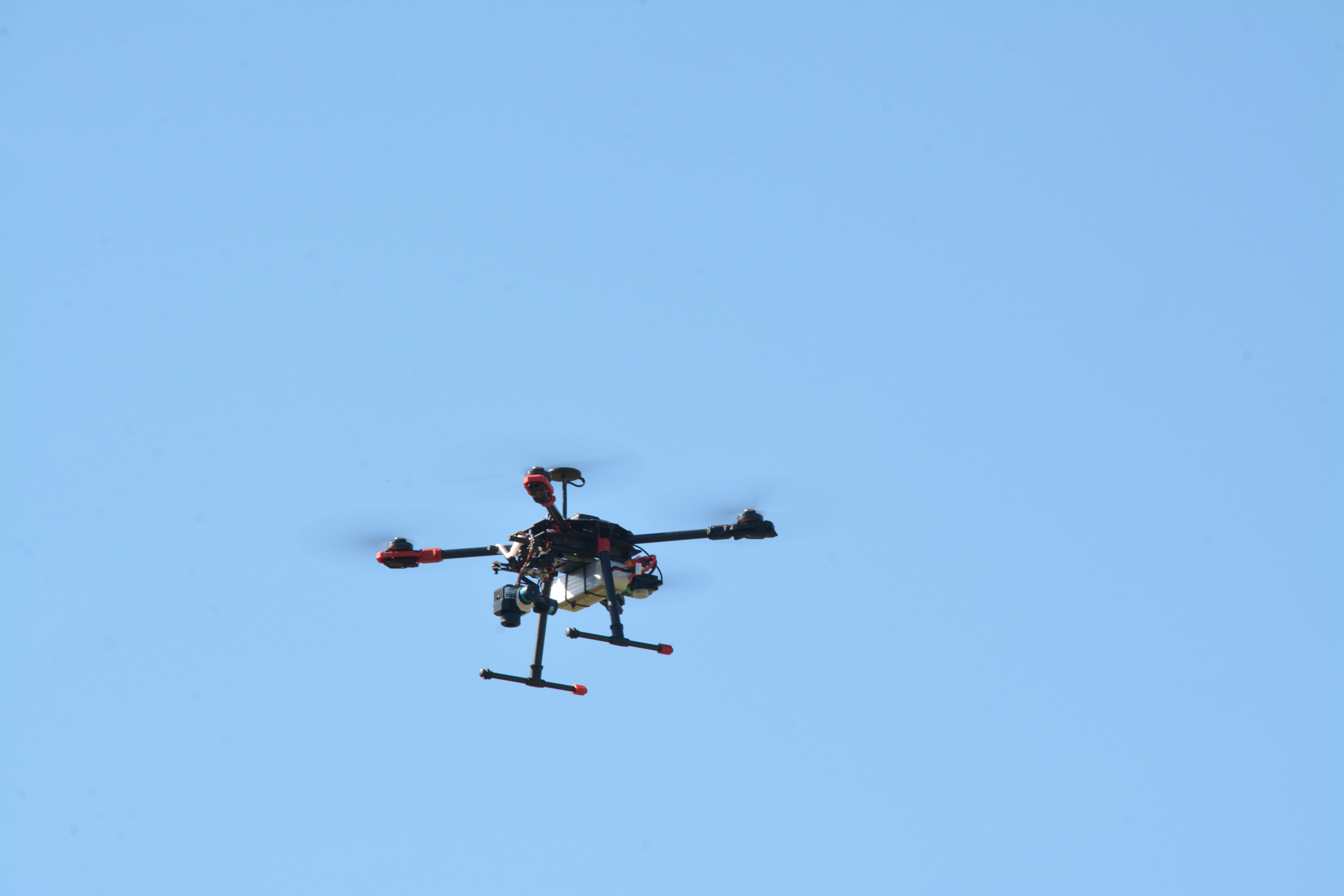
SR01X
A multipurpose original designto integrate any sensor
It is an autonomous robot designed for strategic reconnaissance missions and more.
The robot can be used as an advanced device for environmental and crucial infrastructure monitoring. The ability of H4R to train neural networks (Artificial Intelligence) allows SR01X to perform various tasks, such as: target recognition, biometric recognition, environmental monitoring, water leak searching, infrastructure monitoring and prevention. The Artificial Intelligence drives the robot to take off, land, recharge and carry out missions in complete autonomy. The operator can still intervene in any moment and modify the flight plan with a few easy operations. SR01X is capable of transmitting video streams in high resolution up to 15 km away, or worldwide through the LTE network it is equipped with.
Two custom solutions
Taking a customer-centric approach to make innovative features to our products.
Ability to design and build platforms that can be integrated on any robot of ours, to make them cooperate and work autonomously in any environment.
Ability to create custom software to manage robots and devices singularly and in swarming, making them cooperate in every environment (space, air, land, water).
Ability to design and integrate platforms that support requested software and or sensors on any robot of ours, to make them cooperate and work autonomously in any environment.
All our devices are equipped with Artificial Intelligence, to execute missions autonomously, make calculations and elaborations onboard 24/7 and change profile missions in real time.
Artificial Intelligence implements a navigation system that guarantees a centimetric accuracy in landing.
To navigate using satellite images updated in real time.
A quick and easy to handle way to interact with Artificial Intelligence.
To prevent what is not contemplated in pre-existing model.
Artificial Intelligence enables our devices to position and move according to target and mission programs.
Remarkable duration to secure data collection and accomplish missions.
To know and monitor a target status can help to prevent failures, safety issues and avoidable expenses.
To reduce reflection and optimise data collection quality.
Robot and mission safety is a primary concern and obstacle avoidance is guaranteed.
Our robots actively communicate and arrange to manage missions like a swarm, in which everyone acts according to its peculiar technical characteristics.
To ensure trustable handling of robots and targets even in absence of an operator.
To analyse and detect any detail or process in image composition.
For complex image handling and multipurpose uses.
Able to notice and elaborate image details, to identify humans respecting privacy policies.
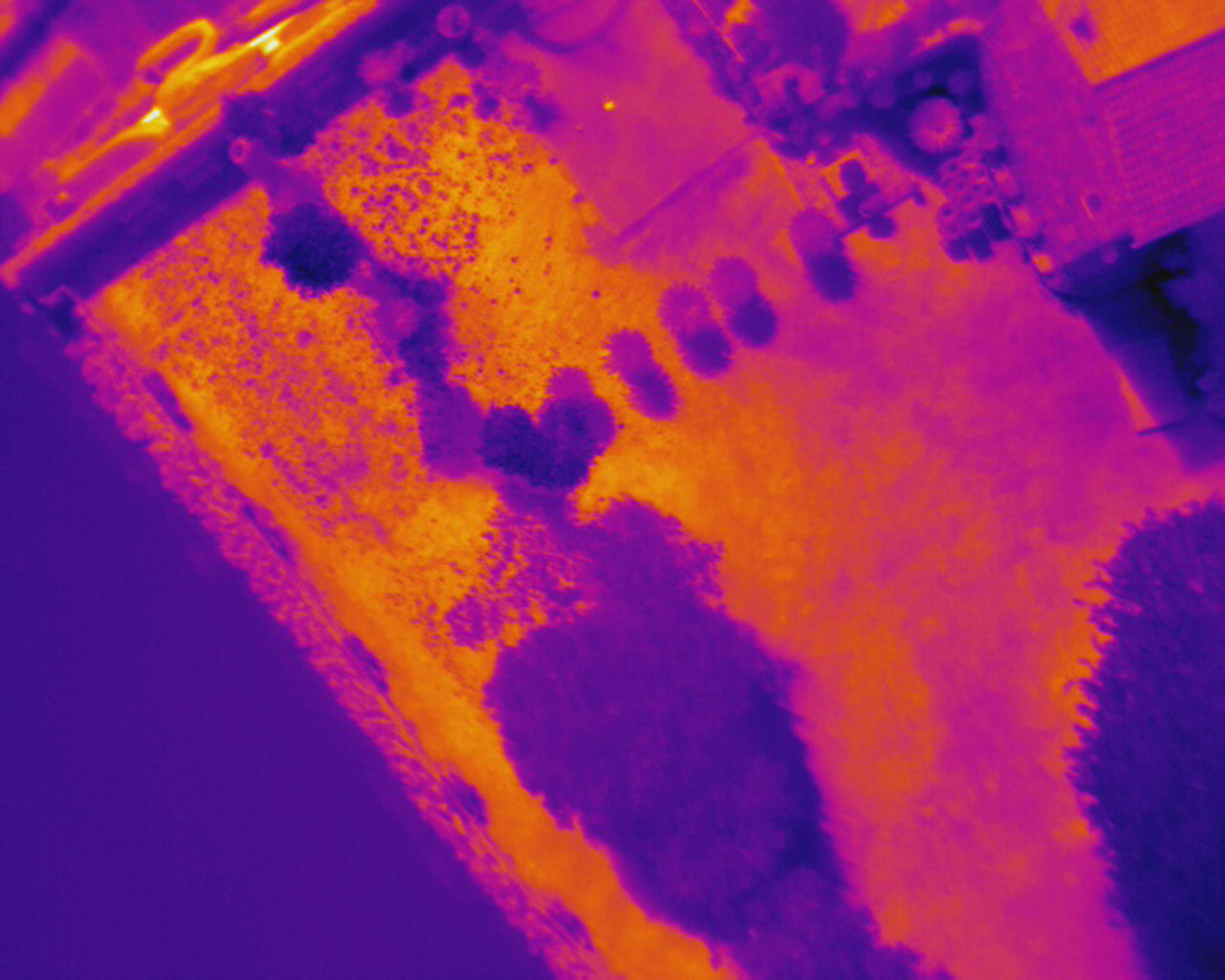
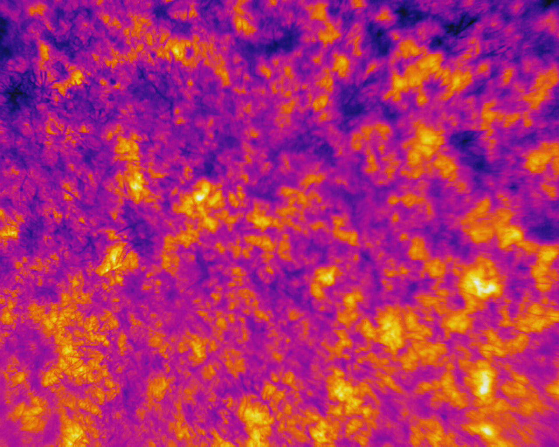
Temperature evaluation at different wavelenghts can provide essential data.
Normalized Difference Vegetation Index describes the vigour level of vegetation and cultures.
To control many variables with one single sensor, reducing size and complexity.
A powerful sensor to investigate several variables.
Application fields
- Area control
- Route pursuit
- Target interception and pursuit
- Waste monitoring
- Analysis of chlorophyll
- Aerial photography
- Photogrammetry
- Crucial infrastructure monitoring
- Chemical agent survey
- Radiation measurement
- Atmospheric agent control
- Prevention


H4R SR01X
Talk with our dedicated team of experts
Answer your questions, experience our cutting-edge solution, discuss any of your needs and to provide you with a quote that suits with your requirements.